|
Ray Hansen's recollections from 1955-58.
Ray Hansen's recollections from 1955-58. |
|
Incidentally, I've finally got in touch with the then camp doctor at Tuto 1957. That was first time the Task Force had one, as I recall. He and I were about the same age and temperment. So we "roomed" together, in the back part of the half-sized Jamesway, the front half of which was his clinic. Dr. Chimer Moore is his name, and he still has an active practice! (On U.S. East Coast, in Virginia). He's going to provide additional info to the info I sent you. Has an interesting story about a research project he was doing (on his own). He had us use gallon sized cans to pee in at night, which we kept in a vestibule of our tents (hence frozen, and not stinky). I never did know what it was for, but he's going to provide more info on that too. It had to do with how long it took to get aclimatized.
I was in Tuto in the 1956 and 1957 seasons. Was Ops O, later 2IC, of the 1st EATF. Also happen to be of Danish extraction, a couple generations back. Speaking of Danes, the Danish Liaison Officer when I was there was Commander Jensen (I have his full name in my files). One of the guys on your list mentioned a personable Danish officer; could well have been Jensen.
Three or four of us old "Greenland Hands" have been considering writing a piece about the Greenland R&D of the 50's, to include a mini-history of Camp Tuto, "Site2", and Century. Among them are a few of the scientists who did the research. We also plan to include a brief chronology of Tuto's development and use. The info on your website--and no doubt through the people listed--will sure help filling in the years we don't know much about.
The aerial photo that Ron Fleichman has on the website is the only time I've seen Tuto's full build-out. It appears to be half again the size we knew. I've written Ron, see if he'll make us a hard copy. I have lots of photos of the R&D projects, which will add zest to the article. Also have copies of annual reports through the late '50s, and of Century's construction.
Will certainly share with you what we come up with. We're shooting for this year, but am sure you know how time gets away during this unpredictable stage of life.
|
ENGINEER ARCTIC TASK FORCE HISTORY
ENGINEER ARCTIC TASK FORCE HISTORY |
The Army Corps of Engineers, in WW2 and afterwards when it was the construction agency for Thule Air Force Base, had extensive experience working in cold regions. Much was learned from that work including how limited was our knowledge of polar regions. We needed to know much more about extreme permafrost conditions, crevasses, the ice cap, strength and properties of snow and ice, and many other design and construction challenges.
Until the early 1950's, most R&D work in the Arctic was by independent agencies, each competing for the limited logistical support available. To coordinate its R&D field work in the Arctic, in 1954 the US Army organized the "First Engineer Arctic Task Force". In 1956 it was put under control of the Assistant Chief of Engineers for Research and Development, its name changed to "US Army Engineer Arctic Task Force" (EATF), and its strength increased to about 300 ("officers and enlisted men," as the Army puts it). In December 1957, the Army accelerated the polar research program as a whole, and appointed its Chief of Engineers as executive agent for its operation. In 1958 the EATF was renamed "US Army Polar R&D Center," with a 50 percent strength increase for a total of about 450. There is far more in its history, as is obvious from the rich experiences described by other contributors to this website. Although my tour ended in early 1958 (at the age of 31), I really enjoy the memories and all the other's adventures with this little-known but unique and highly-successful outfit.
|
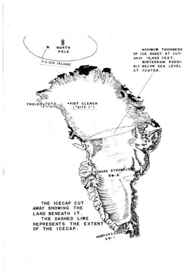
Sketch of Greenland showing its bowl-shaped topography...... |
|

NW Greenland, showing EATF camp locations. Camp Century, not shown, was constructed starting 1958, halfway from Camp Tuto to Site 2...... |
|
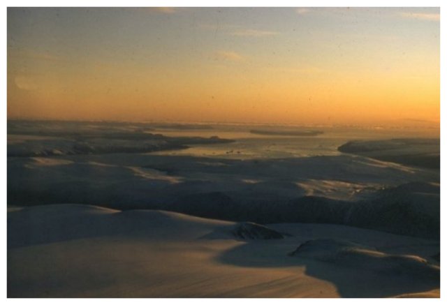
View of Thule Airbase and Dundas Island, from the glacial moraine above Moltke Glacier. On a clear day one might be able to see across Baffin Bay, to Ellesmere Island in the distance...... |
|

Harald Moltke ("Moltke") Glacier, just north of Thule. At the time (approx.1956) this glacier was 5 km long and about 1.5 km wide. It has greatly receded since that time...... |
|

Camp Tuto, end of summer 1957. Beyond it, by the edge of the icecap, is "Lake Tuto" (but it was ice-covered most of the year). The ramp road and ice tunnel are off-photo to the right...... |
|
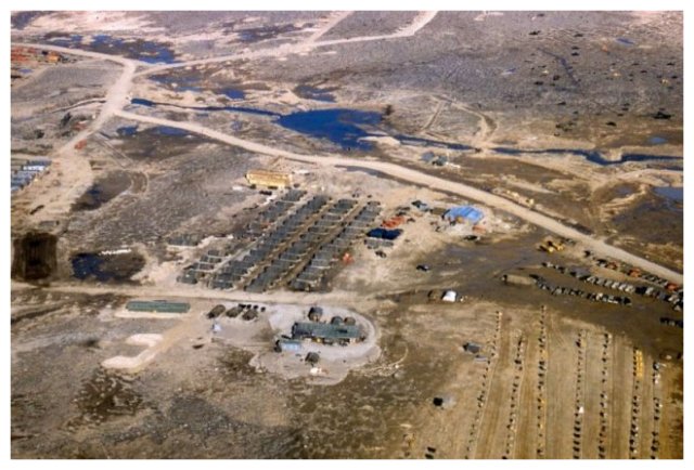
Camp Tuto, 1958. In lower right is supply storage yard. The stacks were kept small and separated to minimize snow drifts and aid in locating and accessing supplies even when snow-covered...... |
|

Camp Tuto "street," spring of 1956. The Operations Office and radios were in the first Jamesway on the left...... |
|

Thule-Tuto road, on a windy spring day. It practically disappeared when snow fell. Tracked vehicles had to be used for most of the year...... |
|
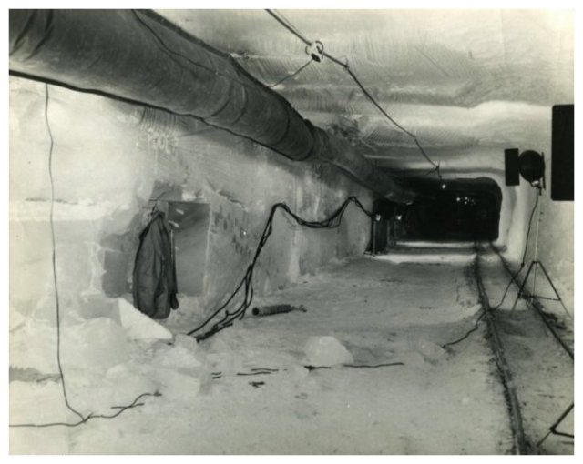
Ice Tunnel, near Camp Tuto, early 1957. Along this main tunnel, several large test rooms were constructed for conducting ice strength studies on various types of ice core storage, and over-winter storage of some equipment. Early digging was done using only hand tools...... |
|
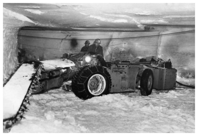
In 1957, Joy Manufacturing Co. coal mining machines were used to enlarge the ice tunnel. The main tunnel was enlarged to 10' x 8', with length of about 1,200 feet, and with side rooms for ice coring, stress-strain studies, seismic studies, research on use of explosives in ice, and evaluation of potentials for military uses...... |
|
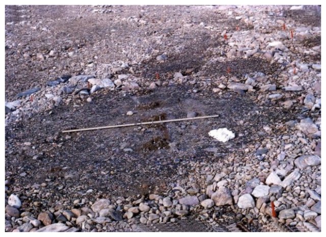
Patterned Ground soil surfaces are created by eons of freeze-thaw cycles. Objective of this work was to determine the nature and magnitude of the forces at work in the soil, and relationships between type of patterns and the nature of the subsurface soils...... |
|
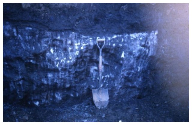
A large ice lens in the permafrost, uncovered during Patterned Ground and Permafrost Studies project...... |
|
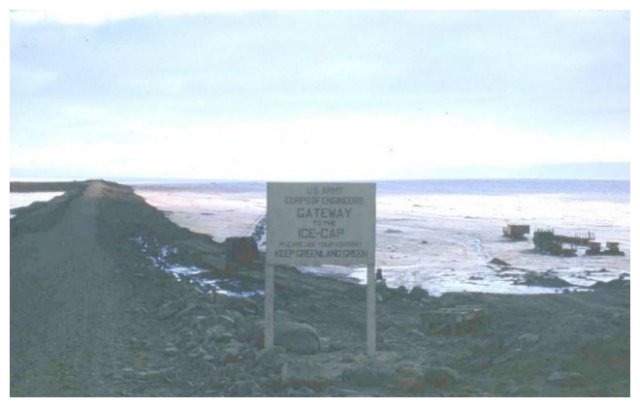
Ice Cap Ramp Road. After determining the route and layout by topographic surveys of ice movements, cracks and summer runoff patterns, the road was built using earth and gravel fill, with steel culverts to handle summer runoff. The road went about a mile up from the icecap edge, enabling vehicles to safely get up through the ablation (summer melt) zone. EATF soldiers couldn't resist posting the "Keep Greenland Green" sign...... |
|

A swing just after ascending the Tuto ramp road, departing for Site 2. Wide-tracked D-9 tractors are pulling cargo and wannigan sleds, accompanied by a few Weasels...... |
|
-->
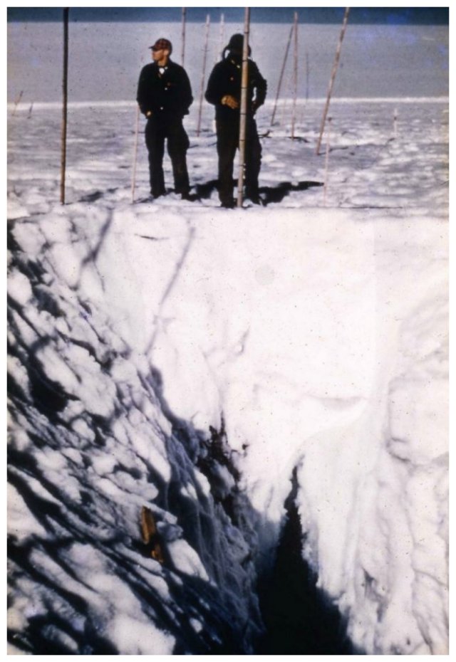
Two US Army Engineer Arctic Task Force (EATF) soldiers overlooking a crevasse they had helped open-up. These Crevasse Studies obtained detailed information on crevasse movements, life cycles, origin, growth, and disappearances--and the snow-bridges the often covered them...... |
|

The radiometer crevasse detetctor mounted on top of a weasel being tested at mile 13. Mr B. Lyle Hansen SIPRE physicist in charge of the project, lies on the weasel top...... |
|

One of many crevasses opened for study. They were inspected and instrumented for size, movement and deformation. Here Lt. Col. Clark is descending, for he wouldn't have anyone do anything he wouldn't. We never lost a man in this work, although came close to losing vehicles...... |
|
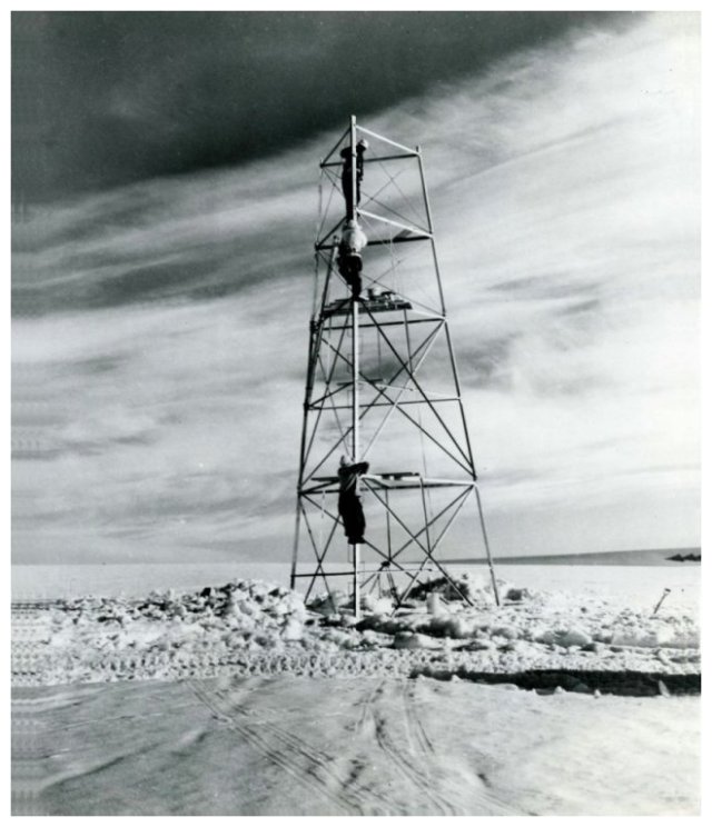
Erecting radiometer tower for detecting snow-covered crevasses using reflected radiation, in the heavily-crevassed "Blue Ice Valley" (near Mile 13). Aircraft-mounted radiometers were also used...... |
|

An electric-field type of crevasse detector developed by US Army Engineer R&D Laboratories...... |
|

An Army helicopter at about Mile 50. It had responded to an accident when a man on the swing had apparently broken a leg. (That's me smiling because the doc had just told us the leg wasn't actually broken and the fellow would be okay.)...... |
|

A modified Failing 1500 rock drill in a snow trench at Site 2, for deep icecap drilling and coring. This work demonstrated feasibility of recovering deep samples, and in 1957 reached depths of over 1300 feet, the deepest ever at the time...... |
|
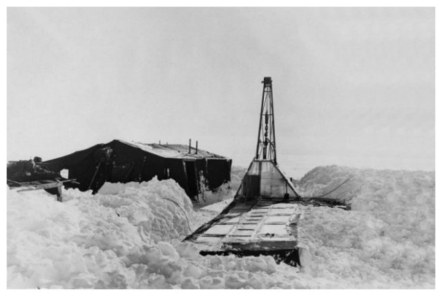
Surface exposure of the drill tower used for raising and lowering the 20-foot sections of drill rods and ice-coring tubes. The surface tents housed power generators, heat exchangers and workshop...... |
|

A core being gently removed from drill tube. Cores were recovered of snows that had fallen over 1,000 years ago. They provided year-by-year information on ancient weather, climate changes, physical and mechanical properties, and entrapped gasses, isotopes, pollen and dust. Subsequent drilling obtained cores of snows that fell over 100,000 years ago. Lead driller, Jack Tedrow, is 2nd from right, and Project Leader, Dr. G. Robert Lange, is 3rd from right...... |
|
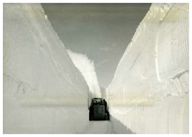
Peter Snow Plow, machine developed by the Swiss for clearing railroads in the Alps. It was used for cutting trenches for undersnow camp facilities at Site 2, and later for Camp Century. One was also used at Byrd Station, Antarctica...... |
|
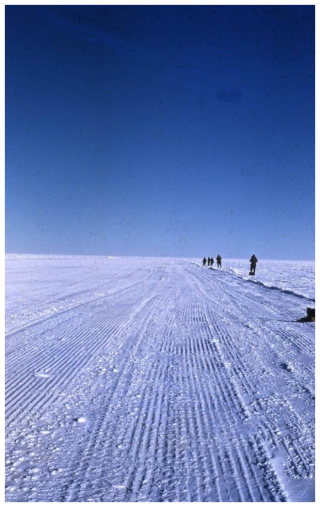
We are watching with fingers crossed as a wheeled C-54 comes in to land on the test runway. The elevation, at Site 2, was 7,200 feet...... |
|
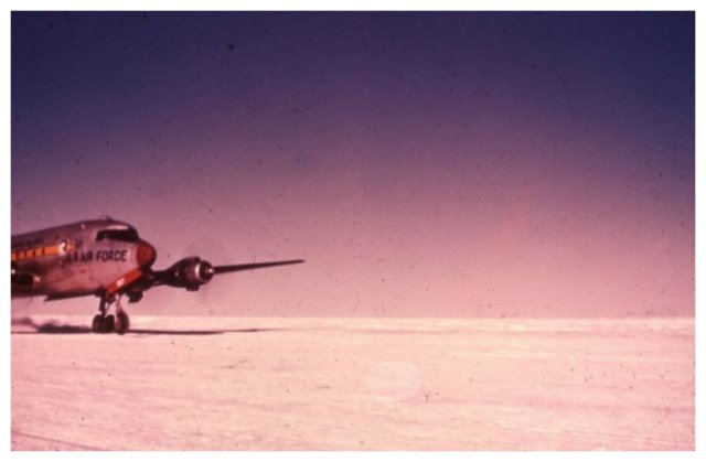
The snow-compacted runway proved fully capable of supporting the C-54...... |
|

The C-54's wheel loads and landing performance were correlated with amount and type of compaction work that had been applied. Obviously this surface passed!..... |
|
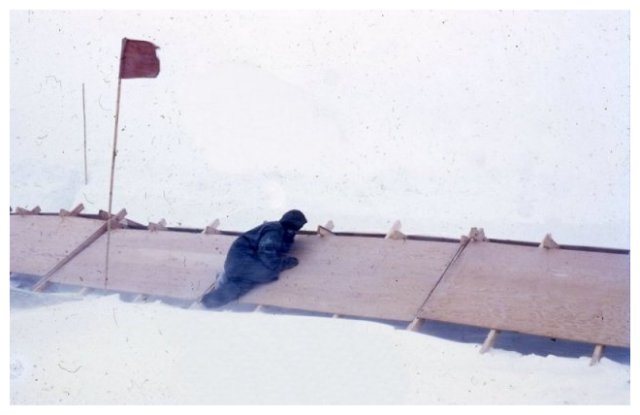
Snowdrift Studies, Site 2, 1957. One of various snow fence configurations tested to control snow build-up on the runway...... |
|
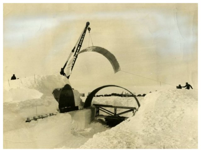
EATF equipment operators placing steel arch sections over a trench dug by a Peter snow plow, for undersnow camp construction tests at Site 2. This type of roof was subsequently used for Camp Century and Byrd Station in Antarctica. In the background is Camp Fistclench. [Anyone know where that name came from? I don't.-R.H.]...... |
|
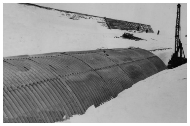
EATF soldiers installing various kinds of roofs and roofing materials for undersnow camp construction tests, at Site 2 in 1957...... |
|
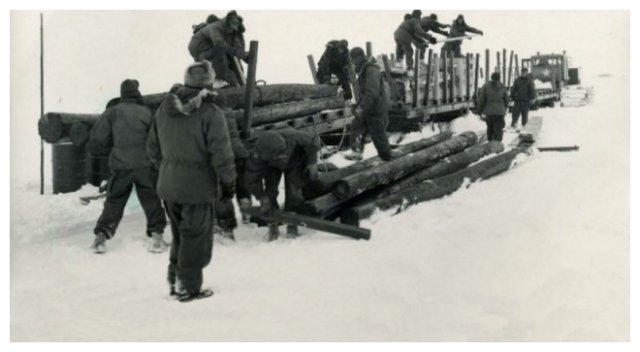
Timbers for piling are unloaded by USAEATF and SIPRE personnel at Camp Fistclench. This project was aimed at determining proper design for pilings for support of surface installations on the ice cap...... |
|
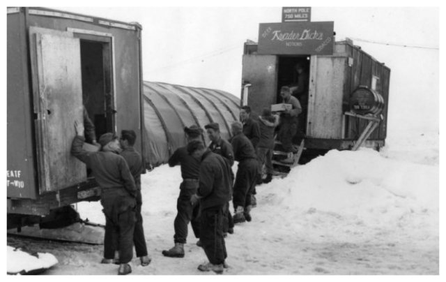
EATF's PX/country store at Camp Fistclench. EATF soldiers joyfully unloading PX supplies from wannigan of a recently-arrived swing. It was a warm day from the looks of the clothing-but the supplies (and beer!) usually arrived frozen...... |
|

Topside photo of Camp Century. It was built at about Mile 100 starting in 1958, after I had left. In subsequent years, snow accumulation "buried" the camp even further, and those air vents were raised accordingly...... |
|
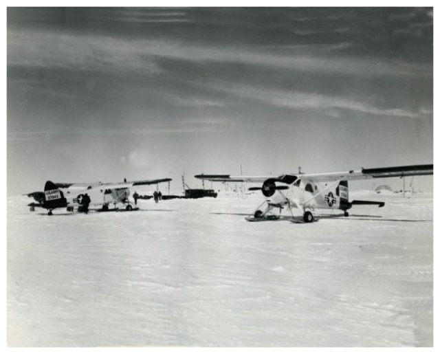
Ski-equipped L-20 light aircraft on the airstrip at Camp Fistclench. Transportation Corps aircraft carry mail and personnel to and from remote camps in Greenland when conditions permit....... |
|

T-3 runway when I arrived with the EATF team. Crashed C-124 was off-photo to right. The AF people were able to extract the cargo-- including the most precious item of all, for us, a full-sized road grader. T-3 was also known as Fletcher's Ice Island, for Col Joseph O. Fletcher, USAF pilot, geophysicist, and meteorologist, who was first to spot it...... |
|

T-3. Small (Cat D-2?) tractor-dozer with grader and roller. They look like Army airborne-engineer equipment...... |
|

To level the T-3 runway we filled the low spots with material scraped off the high spots. After being compacted, the fills froze up hard during the much-colder nights...... |
|
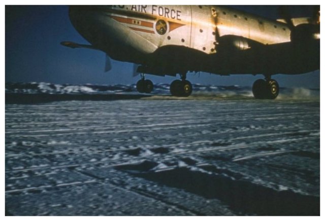
The first C-124 ("Globemaster") to make a successful landing on T-3, the day after we finished the runway...... |
|
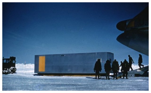
T-3. International Geophysical Year (IGY) personnel and equipment unloading the first of the several successful C-124 wheeled landings.
To include information I have recently learned, from a US Air Force historian, that there had indeed been C-124 landings on T-3--when it was in another Arctic Ocean location, in an earlier year...... |
|
>
Mail to: Ray S. Hansen 
|
© Copyright: By Steffen Winther. Owner of the Thuleforum — All rights reserved. December the 3rd, 1996 - .
|
|